
Chakravuyh (Heavy Payload Drones)
The Personalized Aerial Vehicle (PAV) is an autonomous platform with a 100–150 kg payload, GNSS-based navigation, and real-time route planning. It ensures safety and connectivity with multi-radio communication and an intelligent emergency landing system.

Ti-Shadow (Small Category Surveillance Drone)
Advanced ISR and surveillance drone system designed for real-time monitoring and data collection across diverse environments. Enables efficient aerial surveillance, situational awareness, and supports a wide range of applications including security, research, and resource management.

KALA (Medium Category Payload Carrier)
Advanced drone with precise payload dropping mechanism for accurate delivery at target locations. Demonstrated for military and operational needs.

Ti – Circle (Flight Controller)
Ti-Circle is a custom flight controller for advanced drones, featuring integrated GPS and mobile network-based tracking for real-time location monitoring. In case of signal loss, it relays the drone's last known position, ensuring safe recovery and mission continuity. Its robust design suits both commercial and research UAV applications
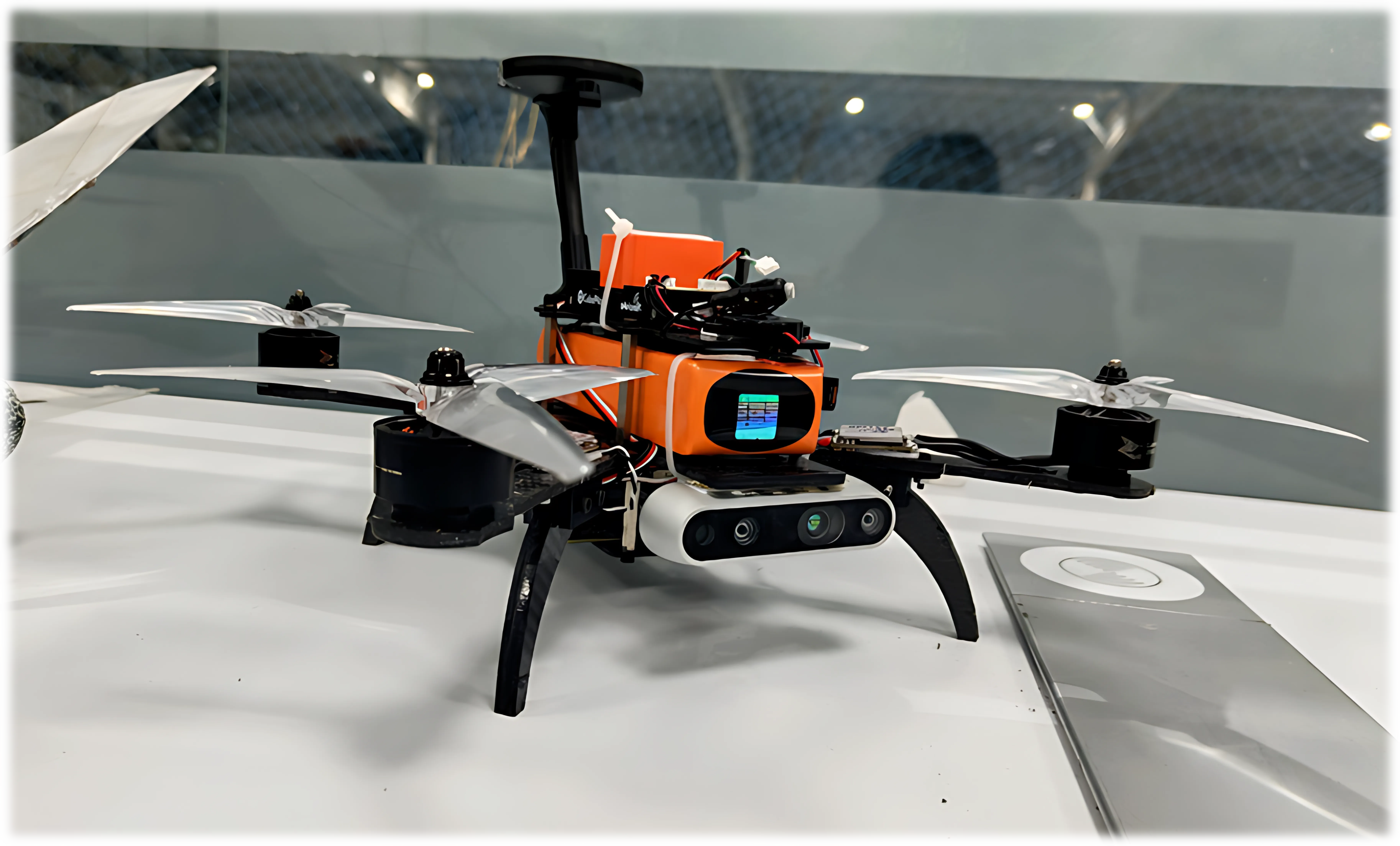
Indoor GPS Navigation Drone
Advanced indoor navigation system for a Micro Aerial Vehicle (MAV) using monocular Visual Inertial Odometry (VIO) for precise positioning and navigation in GPS-denied environments.
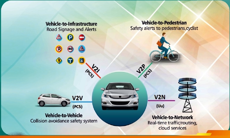
Cellular Vehicle-to-Everything
CV2X Connectivity enhances road safety with features like Emergency Vehicle Warning, Speed Limit Compliance, and Pothole Detection. It optimizes traffic management and communication, ensuring safer, smoother journeys for all road users. CV2D enables vehicle-to-drone connectivity.

Autonomous Campus Shuttle
ACS with Map-Based Navigation leverages high-definition maps and real-time localization to guide autonomous vehicles efficiently in controlled environments.

Drive-By-Wire High Speed Autonomous Stack
Drive-By-Wire (DBW) system and Autonomous Navigation Stack in a commercial electric vehicle, demonstrating precise control and stability at high speeds, tested up to 70 km/h.